Meteorológiai esélylatolgatások
Még egy kvotésön:The other possible scenario is that in the next few weeks there is a significant increase in the WAFz/poleward heat transport that begins to perturb the stratospheric PV in early January. Potentially this could result in a robust SSW and even a major mid-winter warming (MMW where the zonal wind reverses from west to east at 60°N and 10hPa). Given that the QBO is in its westerly phase this might be difficult and instead the stratospheric PV becomes stretched or elongated such that the flow switches from westerly to northerly over North America and Northern Asia. This would favor colder temperatures for parts of Canada, the US and Northern Asia. I believe to force colder temperatures in Europe would likely require a more robust perturbation of the stratospheric PV and that elongation of the PV would not likely be sufficient.
As I have written in recent posts, the anomalous wave pattern in the mid-troposphere has been 180° out of phase with the climatological wave pattern. Strong destructive interference between the two is resulting in below normal upward Wave Activity Flux (WAFz) or poleward heat transport (Figure 11). Below normal poleward het transport has allowed for the PCHs to cool in the stratosphere and for the stratospheric PV to strengthen next week (Figure 12). I believe this is a critical juncture in the winter with two divergent most likely paths. One possible path is that a troposphere-stratosphere-troposphere cycle is commencing that favors cold PCHs, a strong PV and a positive AO. The likely impact on the NH weather would be an upcoming mild period (as predicted by the weather models) followed by a possible brief return to colder weather before the mild period returns sometime in January and lasts much of the remaining winter months. This scenario is the one that I consider suggested by the most recent PCH forecast.
Így se találtam meg, november 19 - december 19, és január 3-ig terjedõ részeket találtam. Nem állítom, hogy minden mondatát értem, de hol történik január 3 utáni részrõl elemzés? Be tudod másolni nekem?
Utolsó észlelés
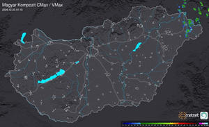
Térképek
Radar
Aktuális hõmérséklet
Aktuális szél
Utolsó kép
Indul a MetNet előrejelzési verseny sorozatának 40. sorozata
MetNet | 2024-05-03 15:08
Szabályzat